- RGA Day 4 - Overview
- Photos
Friday, June 27, 2008
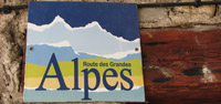
La Route des Grandes Alpes Day 4: Lanslebourg to Briançon
COL SIGNS


115.8 km total
Col du Télégraphe 1,566m
Collet du Plan Nicolas 2,406m
Col du Galibier 2,645m
Col du Lautaret 2,058m
So, as we had stopped in Lanslebourg instead of Bramans, today would become our longest day. Our road would take us over Télégraphe and Galibier. Well, it turned out that this stage would also show our highest average speed (20.64 kmh).
The ride through the valley towards Modane and then St-Jean-Maurienne was better than expected. The road was not very busy and the views are beautiful. We made it up to Télégraphe…easy. We had a fast descent to Valloire and started the climb towards Galibier. We stopped at Plan Lachat where Katy insisted on snapping a few pictures.
The descent to Lautaret is technical. Somehow we failed to locate that col sign. Further on to Briançon was easy and fast. A few motorcyclists gave us thumbs up and camping cars let us pass. Great to share the road with such people. As always, Secret Weapon had things perfectly organized by the time we got to Briançon.
This was another great day.
Return to Summary <-- / --> View Previous Day <-- / --> View Next Day
Date: {@copyrightdate}
Equipment: {@equipment}
Photographer: {@photographer}
Date: {@copyrightdate}
Equipment: {@equipment}
Photographer: {@photographer}

Date: {@copyrightdate}
Equipment: {@equipment}
Photographer: {@photographer}