- Trip Overview
- Photos
Vallée Verte: Tour of 6 Cols
Saturday, May 10, 2008
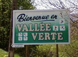 Col de Saxel, Col de Terramont, Col de Jambaz, Col du Feu, Col des Arces and Col du Cou may not be household names but around here, cyclists know to head toward Vallée Verte for training climbs. Eric rode a similar loop with Will a couple of months back and he has been eager to show me the region. The smaller roads leading up to each col were practically traffic-free and the few cyclists who passed us (on their race bikes) were each focused on getting to the top of the cols as quickly as possible. While these cyclists huffed and puffed past us, Eric chatted on about our upcoming Routes des Grandes Alpes tandem tour and even sang from time to time (I think mostly to annoy the other cyclists).
It is unsurprising why the region is named Vallée Verte (Green Valley). The mountains that surround this region are low enough to be fully covered in greenery.
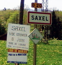
Our first real climb started at the foot of Bons-en-Chablais. After meeting Barry along Route du Tailleul (see sidebox), the road continued gently up through the woods to Col de Saxel (944 m). As we were passed by a couple of vans ladened with cycling sponsor logos, Eric commented that it is quite usual to see cycling clubs (and their vans) in this region.
Upon reaching Col de Saxel, we pressed onward and descended to Boège. In order to make this trip more pleasant and avoid main roads, we turned northeast onto D40 towards Habère-Lullin. This was a pleasant stretch with minimal traffic and decently paved road. We turned onto a bigger D12 and reached Habère-Poche in the company of a group of cyclists.
It became clear to us as we approached Habère-Poche (950 m) that a race was in progress. Dead give-aways were a sign "Ravitaillement" and a few people wearing team-jersies holding bottles of water and positioned next to their vans (a few we recognized as those that had passed us earlier on). We stayed put at Habère-Poche and watched the Tour du Chablais race.
 A good 15 minutes later we continued toward our second col, Col de Terramont (1096 m). This was a fairly easy ascent coming from Habère-Poche. From there we descended to Col de Jambaz (1027 m) and turned onto the wooded (and sometimes chilly) D26 north toward Lullin via Bellevaux. We were quite happy to find a cold water fountain at Le Lavouet (767 m). Our three water bottles were completely dry by then.
We reached Lullin (840 m) after a small climb from Le Lavouet and were greeted like an old friend by the owner of Hotel de la Poste. We enjoyed nice food and drinks and made friends with the locals. I highly recommend her home-made cheese bread.
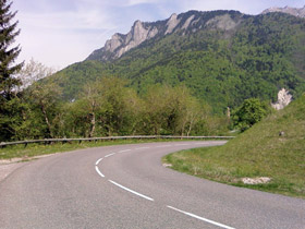 Feeling fully satisfied, we continued toward Col du Feu (1117 m). While it was not a long climb from Lullin, it was the steepest climb of the day.
Just before reaching the col, we drove through a fresh patch of cow dung (yuck). This resulted in the "headless" photo (see Photos tab column 2 row 5) where Eric rode circles through the grass determined to get rid of the undesired muck.
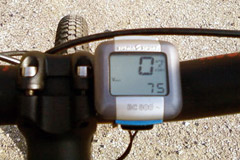
From Col du Feu, we descended quickly (reached 75 kmh max speed) down a steep local road to Vauverdanne and again started our next climb. We reached Col des Arces (1164 m) along the narrow road. Our return from Col des Arces took us to the northern boundary of Habère-Poche where we turned our attention to our last climb, Col de Cou (1116 m). Just in case you can't truly figure out where you are once you get there, there are 4 markers for Col de Cou (see last photo on Photo tab).
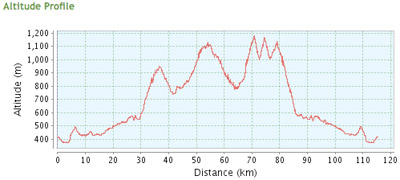 From Col du Cou, we descended down a tree-lined D235 to Fessy. With the exception of a few minor ups and downs, it was again an easy and fast descent back home to Geneva. Sunburns aside, it was a fantastic trip.
- Katy, 5/11/2008
Total trip distance: 115.2 km (per GPSies) 118.0 km (per Sigma counter)
Altitude Range: 807 m (372 to 1,179 m)
Total ascent: 2,046 m
Data source: www.gpsies.com

